


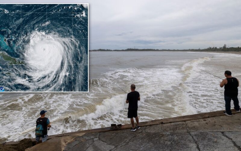
Hurricane Erin ramped up once again to a category 4 storm early Monday as it blew past Puerto Rico, prompting evacuations in South Carolina’s Outer Banks, and promising to bring deadly rip tides and surf to the entire East Coast through much of the week.
The National Hurricane Center has predicted a high probability of dangerous rip currents and surf as far north as New York and Long Island by Tuesday. South Carolina officials on Monday had already declared a local state of emergency and ordered Hatteras Island to evacuate as coastal flooding could start “more than 24 hours before any tropical storm force winds arrive,” the National Weather Service said. In Puerto Rico, the storm knocked out power to thousands of people.
As of 8 a.m. Monday the Atlantic season’s first major hurricane was traveling northwest at 13 mph, expected to gradually turn north and parallel the U.S. coastline just west of Bermuda, its strength ebbing but its reach expanding.
NOAA
A graphic from the NOAA shows the earliest arrival time of tropical storm force winds from Hurricane Erin. (NOAA)
“Erin will remain a dangerous major hurricane through the middle of this week,” the NHC warned. “Swells generated by Erin will affect the Bahamas, Bermuda, the east coast of the United States, and Atlantic Canada during the next several days. These rough ocean conditions will likely cause life-threatening surf and rip currents.”
While Erin was expected to turn east “well before it gets anywhere near us,” it would churn up surf along New York’s coastlines, including Long Island, making for “pretty dangerous conditions,” National Weather Service meteorologist Dave Rampell told the Daily News.
Wednesday and Thursday would be “the worst of the worst,” he said, making them “not good days to be in the water at the beach.”
Waves on the open ocean will reach 12 to 15 feet, and beachgoers could see 8 to 10-foot surf, even as tempting sunny conditions and some upper-70s temperatures overtake the region’s recent heat and humidity, he said.

RICARDO ARDUENGO/AFP via Getty Images
A truck drives through a flooded road in Naguabo, Puerto Rico as Hurricane Erin leaves the region on August 16. (Photo by RICARDO ARDUENGO/AFP via Getty Images)
The storm itself carried 130 mph maximum sustained winds and even higher gusts but was generating hurricane-force winds up to 80 miles from the center and tropical-storm-force winds as far as 230 miles out, the NHC said.
The central Bahamas braced for tropical storm conditions as Erin’s outer bands promised to dump 2 to 4 inches of rain on portions of Hispaniola, Turks and Caicos, and other parts of the Bahamas, with the potential for up to 6 inches in some areas, the NHC said.
With News Wire Services
Originally Published: