


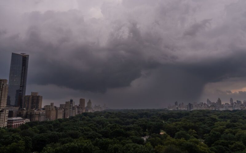
More than 43 million people across the eastern United States are under a severe thunderstorm watch, with forecasters warning of heavy rain, damaging winds, large hail, flash flooding and isolated tornadoes.
A severe thunderstorm watch — issued when conditions are favorable for storms capable of producing hail one inch or larger, and winds of 58 mph or more — will remain in effect until at least 8 p.m. Saturday from eastern Pennsylvania to southern Maine, including the tristate area.
A severe thunderstorm watch has been issued for parts of CT, DE, ME, MD, MA, NH, NJ, NY, PA, RI, VT until 8 PM EDT pic.twitter.com/cKsM6GLnDd
— NWS New York NY (@NWSNewYorkNY) September 6, 2025
“As a cold front sharpens and begins to push toward the coast, scattered to numerous storms should develop by mid to late afternoon and continue into this evening,” the National Weather Service in New York said in its late morning update.
Stronger, more organized storms could bring torrential rain and damaging winds, increasing the risk of flash flooding. An initial line of storms is expected to hit northern New Jersey and the New York City metro between 3 and 6 p.m., followed by weaker lines later into the evening.
The potentially dangerous weather is the result of a low-pressure system pushing a cold front eastward across the Appalachians and into the Northeast.
In the tristate area, some storms are likely to become severe as they move from west to east. Forecasters said there’s a “slight risk” of severe thunderstorms for the New York City metro area, the Lower Hudson Valley, northeast New Jersey, and southwest Connecticut, while most of Long Island and southeast Connecticut are under a “marginal risk.”
Wind gusts could exceed 58 mph. There’s also a risk of an isolated tornado and hail up to 1 inch in diameter within the slight risk area. Minor urban and poor-drainage flooding is possible, with a localized risk of flash floods.
Even though streams and creeks are currently low due to dry conditions, multiple rounds of heavy rain could trigger scattered flash flooding in urban areas, according to the NWS.