


New York City is gearing up its first major winter storm of 2026 — and it could be one of its worst in years.
A winter storm watch has been issued for the tri-state area from late Saturday night through Monday afternoon, with a cold weather advisory slated to go into effect Friday night.
After an unseasonably warm Thursday, with highs hovering in the upper 40s, a brutal cold is expected to grip NYC before the winter storm strikes this weekend. By Friday night, temperatures are expected to plummet to as low as 11 degrees, with highs throughout the weekend set to remain in the teens, according to the National Weather Service. The wind chill could make temperatures feel as low as -15 degrees during the overnight hours.
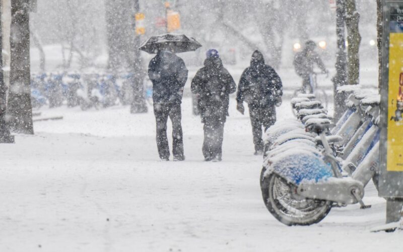
The city could see its first first flakes starting as early as Saturday night, and it will only intensify from there. The snow is expected to be its heaviest throughout the day on Sunday, tapering off overnight into Monday morning. By the time the weekend ends, the city could be left with anywhere between 8 and 12 inches, but the total accumulation is “highly dependent on the track and intensity of a coastal storm that forms and any mixing in of sleet and freezing rain,” according to Accuweather.
“A more intense storm with little or no mixing in of sleet may result in a foot of snow,” it said.
The last time Central Park saw over 12 inches was in early February 2021, when it was blanketed in more than 17 inches.
Outside New York, from Texas to Georgia as well as the Northeast, millions more will feel the storm’s wrath. As of Friday morning, governors from more than a dozen states have issued states of emergency in anticipation of its arrival.
Travel conditions this weekend will also be less than ideal as a result of the ferocious storm, especially on Sunday, when it is expected to snow the hardest.
“Air travel will likely be a nightmare this weekend into early next week. Travel chaos may ensue, making it very challenging for air passengers to make their way to their destinations, perhaps for days on end, as the US air system is impacted by the major storm and then begins the slow recovery process,” AccuWeather Chief Meteorologist Jonathan Porter said.
Already, around 1,500 U.S. flights that were scheduled to depart Saturday have been canceled, according to FlightAware.
The NWS further warned that “roads, and especially bridges and overpasses, will likely become slick and hazardous,” adding that “visibilities may drop below 1/4 mile due to falling and blowing snow.”
Citywide pre-snow treatment will begin Friday in anticipations of the snow and ice impacts, with two thousand sanitation workers set to start 12-hour shifts on Saturday.