


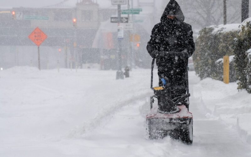
New Yorkers only just freed from the snow and ice left by January’s monster storm will once again face winter’s wrath.
The National Weather Service on Saturday issued a blizzard warning across all five boroughs, as well as Long Island, the Lower Hudson Valley and much of New Jersey. The warning is in effect from 6 a.m. Sunday until 6 p.m. Monday.
The upcoming storm comes courtesy of a growing nor’easter that could dump more than a foot of snow on the Big Apple and the rest of the tristate area. It could also bring “heavy blowing snow and winds gusting up to 55 mph,” resulting in whiteout conditions, forecasters said.
“Confidence is increasing in a major coastal winter storm that will bring significant snowfall and strong winds to New York City,” NYC Emergency Management wrote on social media Saturday morning. “Total snowfall is currently forecast around 13 to 17 inches, with higher totals possible in southern parts of the city.”
Flakes are expected to begin falling as early as 4 a.m. Sunday but be light until the early evening. Heavier snow is expected to roll in around 6 p.m. and be at its most intense overnight and Monday morning — coming down faster than 2 inches per hour at times, according to the NWS.
Meteorologists have warned of treacherous travel conditions for Monday commuters as “areas of blowing snow could significantly reduce visibility,” while the “combination of gusty winds and heavy wet snow could bring down tree branches.”
Minor coastal flooding is also expected, “with a strong chance of moderate flooding along Jamaica Bay, Staten Island, the Battery, and parts of the Bronx and northern Queens,” officials said.
The precipitation is expected to taper off entirely by early Monday afternoon, at which point New Yorkers will once again have to dig themselves out of the snow.
Temperatures will stay cold enough for it to stick through at least the middle of the week, before conditions begin to rebound. By next weekend, highs could reach the low 50s, with clouds giving way to some much-needed sun.
The city was walloped by a major winter storm at the end of January, which dumped more than 10 inches of snow in Central Park and resulted in the cancellation of thousands of flights.
In the weeks since, NYC and the surrounding areas have faced frigid temperatures, which has allowed for the white stuff to linger. Some of the plowed back mountains of snow, which for weeks choked traffic on both sidewalks and streets, still remained as of Saturday morning.
Meteorologists have said that any “small variations” in the storm’s track could drastically alter the predicted snowfall totals.
Dan DePodwin, AccuWeather’s vice president of forecasting operations, said just a “small wobble” in the storm track could make a huge difference in snow totals for cities near the heavily trafficked highways that connect the tristate region.
“The exact track of this storm, along with how quickly it strengthens, will determine how much snow falls in the mid-Atlantic and Northeast,” said Dan DePodwin, AccuWeather’s vice president of forecasting operations. “The supply of cold air is limited, and that could also affect snowfall totals.”